Public Works Mapping Applications
2023-2024, Clark County Government Center
GIS Scripting | Cartography & Data Visualization | Web Design | Data Entry
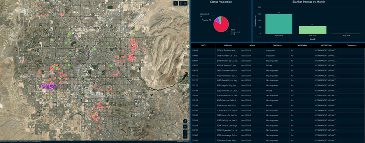
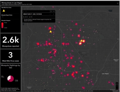
Managed spatial data for the county-wide Public Works department using ArcGIS Pro/Online to map 130+ community infrastructure projects, produce interfaces for data sharing, and manage inventory across an organization of 450+ employees.
Tools
- ArcGIS Pro
- Feature & Attribute Editing (Merge Polygons, Edit Vertices, Calculate Field, Joins & Relates, Definition Query, etc.)
- Layout Creation
- Georeferencing
- SQL, Arcade, Python
- ArcGIS Enterprise
- ArcGIS Online
- Dashboards
- Experience Builder
- Story Maps